


Airport Voting District, Suffolk city, Virginia
About
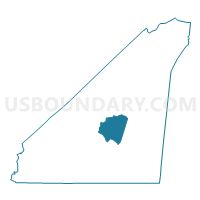
Outline

Summary
| Unique Area Identifier | 683219 |
| Name | Airport Voting District |
| County | Suffolk city |
| State | Virginia |
| Area (square miles) | 14.22 |
| Land Area (square miles) | 14.22 |
| Water Area (square miles) | 0.01 |
| % of Land Area | 99.96 |
| % of Water Area | 0.04 |
| Latitude of the Internal Point | 36.68086910 |
| Longtitude of the Internal Point | -76.62393900 |
Maps


Graphs
Select a template below for downloading or customizing gragh for Airport Voting District, Suffolk city, Virginia


Neighbors
Neighoring Voting District (by Name) Neighboring Voting District on the Map
- Cypress Chapel Voting District, Suffolk city, VA
- Holland Voting District, Suffolk city, VA
- Kilby's Mill Voting District, Suffolk city, VA
- Southside Voting District, Suffolk city, VA
- Whaleyville Voting District, Suffolk city, VA
- White Marsh Voting District, Suffolk city, VA
Top 10 Neighboring County Subdivision (by Population) Neighboring County Subdivision on the Map
Top 10 Neighboring Place (by Population) Neighboring Place on the Map
Top 10 Neighboring Unified School District (by Population) Neighboring Unified School District on the Map
Top 10 Neighboring State Legislative District Lower Chamber (by Population) Neighboring State Legislative District Lower Chamber on the Map
Top 10 Neighboring State Legislative District Upper Chamber (by Population) Neighboring State Legislative District Upper Chamber on the Map
Top 10 Neighboring 111th Congressional District (by Population) Neighboring 111th Congressional District on the Map
Top 10 Neighboring Census Tract (by Population) Neighboring Census Tract on the Map
- Census Tract 757.02, Suffolk city, VA (3,574)
- Census Tract 756.01, Suffolk city, VA (3,574)
- Census Tract 758.01, Suffolk city, VA (3,098)
- Census Tract 757.01, Suffolk city, VA (1,684)
- Census Tract 757.03, Suffolk city, VA (1,551)
- Census Tract 756.02, Suffolk city, VA (1,397)